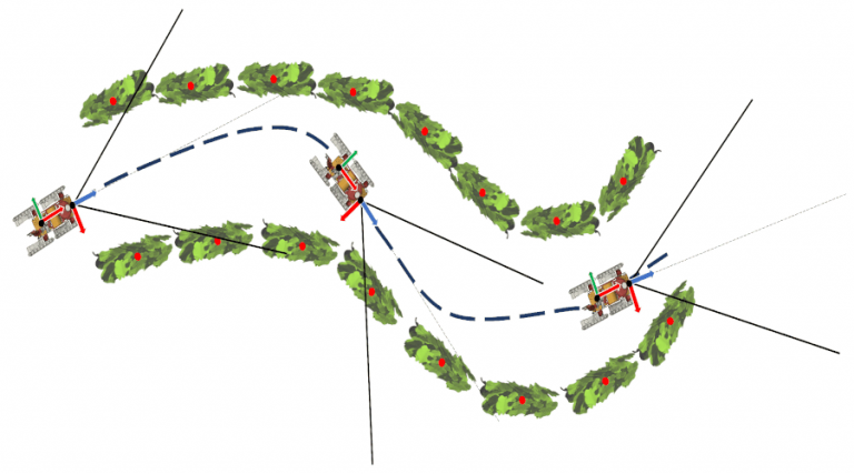
Localization and mapping for autonomous navigation in the vineyard
Localization and mapping are two fundamental parts of the navigation system of an autonomous robot. Mapping is the procedure that allows the robot, using the available sensors, to generate a map of the environment. Localization, on the other hand, is the procedure that allows the robot, using its sensors and a map of the environment, to determine its position and orientation with respect to a fixed reference system.
Are localization and mapping necessary to autonomously navigate a vineyard? Do we really need to create a map of the vineyard with sensors or can we rely on the known structure of the rows? Do we really need a complex localization algorithm or can we just rely on GPS measurements? Are the localization and mapping approaches that are usually adopted in robotics, autonomous vehicles or in the open field suitable for the vineyard, or can we use simpler approaches that are able to exploit, as much as possible, the structure of the rows? Does using artificial intelligence help?
This work aims to answer one or more of the previous questions to develop simple, efficient and reliable localization and mapping techniques to autonomously navigate a vineyard.
This work is suitable for students coming from an engineering background and with experience in using the C, C++ or Python language. A group made up of two students, one from an engineering background and one from a non-engineering background, represents the best solution.